GIS-Integrated Real Estate Evaluation System
Developed a sophisticated real estate platform integrating advanced GIS capabilities for property boundary detection, valuation, and cadastral data processing across international markets.
A sophisticated real estate evaluation platform that evolved from an Australian listing management system into a comprehensive property assessment tool deployed in Rwanda, demonstrating the ability to adapt solutions for different markets and geographical requirements. The system leverages advanced GIS capabilities to provide accurate property valuations and boundary verifications for banks, government agencies, and real estate professionals.
Project Journey
The Challenge
Transform a basic property listing system into a comprehensive evaluation platform capable of integrating with diverse cadastral data sources and supporting field operations in areas with limited connectivity.
The Solution
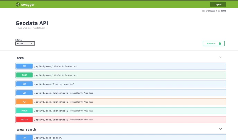
Developed a mobile application with offline capabilities for field evaluators, created a sophisticated GIS integration platform with PostGIS for advanced geographical data processing, and implemented custom ETL processes for cadastral data integration.
The Outcome
Delivered a versatile platform supporting property valuation in multiple countries, providing critical data for bank mortgage assessments, and enabling field operations even in remote areas with limited connectivity.
Key Features
Field Evaluation App
Custom mobile application enabling property assessors to collect and verify data in the field with offline capabilities and automated synchronization.
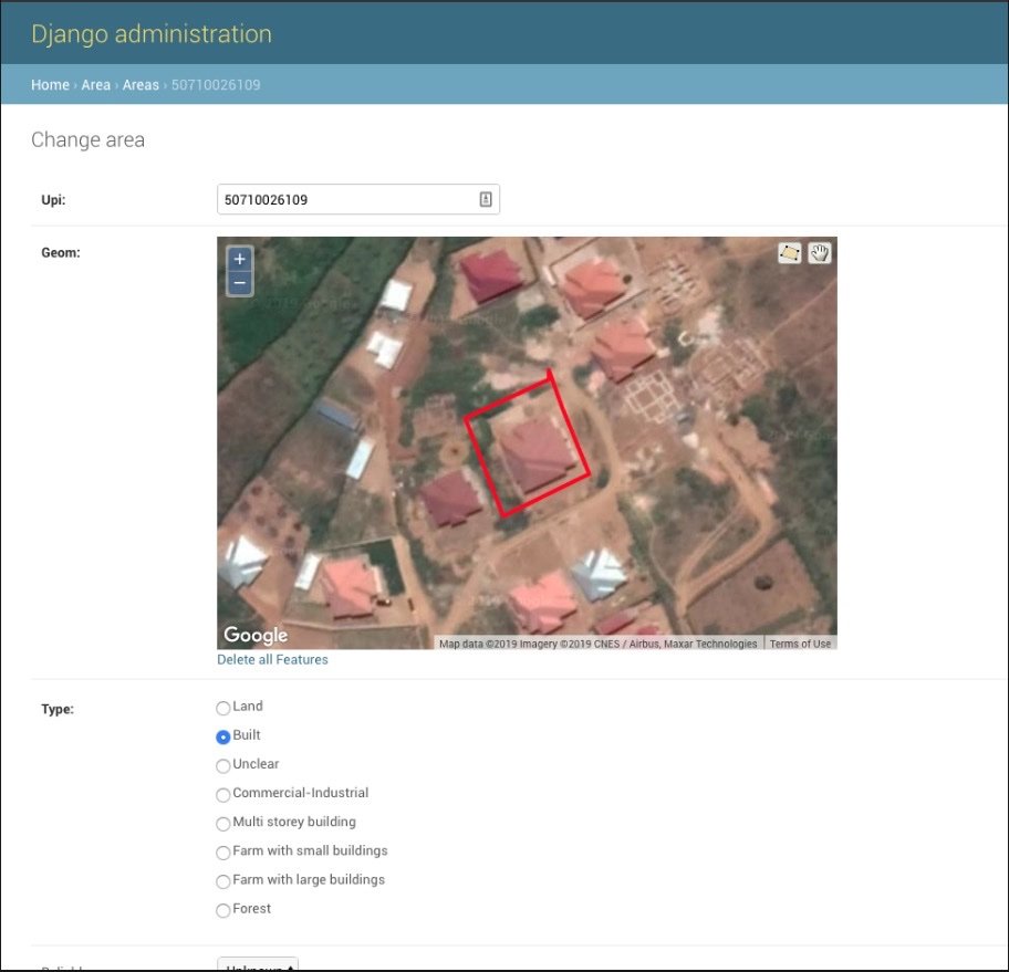
Boundary Detection
Advanced algorithms for property boundary detection and verification using satellite imagery and cadastral data integration.
Spatial Analysis Engine
PostGIS-powered spatial analysis capabilities providing real-time insights into property locations, proximities, and geographical contexts.
Valuation Algorithms
ustom real-time property valuation algorithms incorporating location, comparable properties, and market trends for accurate price estimates.
Bank Reporting System
Specialized reporting modules generating detailed property assessments for bank mortgage evaluations and financing decisions.
Multi-Source Integration
Custom ETL processes enabling seamless integration with diverse cadastral data sources across different countries and formats.
Project Gallery